- The Westshore
- Posts
- Westshore communities may be up for legislated emergency planning upgrades
Westshore communities may be up for legislated emergency planning upgrades
New legislation will require more from municipalities for emergency planning and management
Sidney Coles, Local Journalism Initiative
November 01, 2023
New legislation is supposed to support communities in BC to create pathways to stronger emergency response but it’s more of an elaborate design, not a blueprint.
In his Fairness in a Changing Climate report released on Oct. 3, BC Ombudsman Jay Chalke found that existing Emergency Support Services (ESS) and the Disaster Financial Assistance (DFA) programs in the province “were outdated, under-resourced and failed to meet diverse needs.”
One hour before Chalke issued his report, the Minister of Emergency Management and Climate Readiness Bowinn Ma, tabled the new Emergency and Disaster Management Act (Bill 31) which includes some new and augmented responsibilities that will potentially impact Westshore municipalities.
The BC government wants more clarity from municipalities around what their plans are for all four stages of emergency response management; mitigation, preparedness, response and recovery. In a statement about the new act, Ma said, “The act modernizes how our province approaches emergency management by putting a greater emphasis on preparing for and mitigating the impacts of climate-related emergencies before they happen—keeping people and communities safe from disasters.”
Regulations in the new Emergency Act, if implemented, would mean that municipalities in the Westshore will need to have clearer requirements for risk assessments, emergency management plans, and business continuity plans. They will also need to have well-documented, shared frameworks for multi-jurisdictional emergency management organizations and to fulfill all necessary requirements to consult with and cooperate with Indigenous governing bodies. Along the Westshore, these bodies include the Esquimalt, Ditidaht, Pacheedaht, Hul-qumi’num, Songhees, Scia’new, and T’Sou-Ke First Nations.
The new requirements move municipalities towards increased accountability, organization, cooperation and self-reliance in the face of disaster and emergency management. And while the new bill provides a very detailed bureaucratic framework for chains of fed-to-province command, protocol and consultation, it does not offer very much by way of clear or practical direction for individual communities having to provide emergency response.

Leech River Fault line map. Photo: City of Victoria
Individual communities have to come up with emergency response frameworks themselves
Because of their relative size, municipalities in the Westshore have a diverse and uneven range of resources they can apply to any emergency response. The Metchosin Emergency Program “plans for the response and recovery from emergencies and disasters in order to help protect the health, safety and welfare of the residents of Metchosin.” But what’s clear, in most of them, is an emphasis on individual preparedness.
It’s hard to prepare, though, for the unpredictable. And it’s the unpredictable that Westshore residents may have to worry about most.
It’s likely that the majority of people in the Westshore are at least familiar with maps that show where the most serious risks and impacts in the area may be felt. The Devil’s Mountain Fault zone runs from Washington state to Victoria and an earthquake along it could have an impact of 6.7 to 7.5 on the Richter scale, and the Leech River Fault that runs from Sombrio Point to offshore Victoria. Both are considered active by scientists. The Government of BC website provides information on what to do in the case of an earthquake.
The map also provides detailed information, based on computer modelling, on where the potential reach of tsunamis and their aftermath might be.
The mandate of the City of Colwood Emergency Preparedness program “is to help people to help themselves by preparing for any disaster which would take away the resources of the professional responders and leave members of the community vulnerable and/or isolated for at least 72 hours.” The District of Sooke also encourages families to make sure they have supplies and a plan in place and to “have a grab-and-go emergency kit with supplies for 72 hours.”
With rapidly growing populations, it is more important than ever that municipalities in the region plan and prepare for whatever might come their way. For the Westshore, that means being able to count on paid first responders but it also means relying heavily on volunteers and community-based organizers.
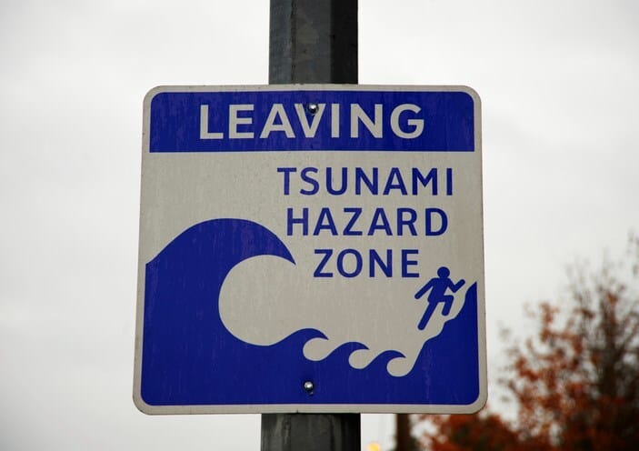
Tsunami risk sign. Photo: Getty Images
In an emergency, Langford Emergency Support Services Team looks to paid first responders to provide critical emergency assistance to residents, but it also trains volunteers to participate in its Emergency Social Services team to coordinate, in the event of a crisis, housing relief, red-cross registrations, food and clothing distribution following an emergency event.
Metchosin established a special emergency response plan for its most vulnerable, the visually or hearing impaired, the disabled, and elders who can register for its program at the Metchosin Seniors Information Resource Centre. And the City of Colwood makes it plain on its website, that even with “its dedicated professional responders (fire, police, medical, municipal engineering and public works), all aspects of the City's Emergency Preparedness is based upon the work of volunteers.” The heavy reliance on volunteers was one of Chalke’s disparagements about emergency planning in the province.
Laurie Pearce, a part-time associate faculty member at Royal Roads University said that a big part of a municipality’s obligation lies in the mitigation phase emergency planning to reduce the likelihood that they have to respond in the first place. In an interview with Continuing Studies at UVic, she added that local and regional governments “let people build in inherently unsafe places such as flood plains, on unstable soils, properties subject to storm surges and surrounded by forests susceptible to fires.”
The first two phases of emergency response are about risk management but should an emergency arise, Westshore municipalities have integrated emergency plans and services available to the public on their websites that deal with response and recovery. The CRD tsunami risk area map includes the Eliza Homes development in Royal Bay in Colwood, which will see condos built along the Cobourg Peninsula. In the event of a tsunami, the registration-based Westshore Alert which covers Colwood, Langford, Highlands and View Royal will provide residents in the region with critical information about evacuation routes and other life-saving information.

CRD Tsunami Information map
As the Westshore grows, and city councils move to make plans to avoid, mitigate and respond to emergencies, they are faced with a complex task. For smaller municipalities like Metchosin and Sooke, having fewer resources dictates what they can and cannot do.
And while the new act calls for a modernizing approach and dialogue between municipalities, more needs to be done for Westshore communities, who, for now, at least, are familiar with an old drill: watch and listen for alerts and be prepared to be on your own for the first 72 hours.
To help municipalities do more, the Union of BC Municipalities created the Community Emergency Preparedness Fund (CEPF) and has scheduled a webinar on Nov. 21 for municipal representatives to learn more about the different funding streams, intake deadlines and how to apply for access to resources that will allow municipalities to do more around all stages of emergency response, regardless of their size.